Wednesday, June 17, 2015

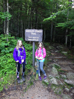
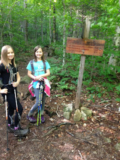
East Osceola. June 17, 2015

Our last New Hampshire hike for a month!  We will soon be on a plane traveling to Asia.  This trip report will therefore be quick.

Greeley Ponds Trail and Mt. Osceola Trail.  5.6 miles out-and-back with 2200 feet of elevation gain.

This is a steep hike -- you have 1.3 miles of easy grade and then it's nothing but steep-steep-steep all the way up.  It made for an excellent morning workout today.


Steepness!

More steepness!

View from the slide.


Heading up the (small) slide.

Looking down a steep bit after having ascended it.

Almost there!  That's the summit.

Summit!

We won't have any trip reports to share for a couple of weeks.  We are off to hike something wonderful -- I will tell you all about it when we are back in the USA.

Happy hiking, everyone!


Little Haystack, Lincoln, North Lincoln, and Lafayette. June 14, 2015

Falling Waters Trail, Franconia Ridge Trail, and Old Bridle Path. 8.9 mile loop, 3900 feet of elevation gain.

Alex, Sage, and I revisited classic Franconia Ridge last Sunday.  This time around, we did the loop counter-clockwise (up Falling Waters Trail first, over the ridge, and down Old Bridle Path).

We had perfect weather and we were on the trails early enough to beat most of the crowds.

We get on a plane tomorrow morning and I have another trip report to write, so I'll let the photos tell the story.

Starting off!

Beginning Falling Waters Trail
Falling Waters Trail passes a few gorgeous waterfalls on the way up to Little Haystack.


Upper portion of Falling Waters Trail
We reached treeline and walked a tenth of a mile to Little Haystack.


View of Cannon's cliffs from Little Haystack.

Sage on Little Haystack
After swigging a bit of water, we traveled to Lincoln.

Alex and Sage on Mt. Lincoln, with Flume and Liberty in the background.
Another short break and it was on to Lafayette.


View of Greenleaf Hut from the ridge


View from North Lincoln

Looking south from North Lincoln

Lafayette, straight ahead!


View south from near the summit of Lafayette
We reached Lafayette and took a half hour break.

Lafayette!
We ate, we drank, we descended...


We were back at the car five and a half hours after we'd left it, which isn't bad.  We hadn't intended to rush, but we made great time nonetheless.

Looking back at the Agonies on the way down Old Bridle Path

It was another fine day in the woods -- and above treeline!

Friday, June 12, 2015

Mt. Hale. June 10, 2015

Our second hike of the week!  This one had to be quick, since we had plans for early afternoon.

We were fortunate to have our friend Samantha with us on this one.  Good times!

Hale Brook Trail, 4.4 miles roundtrip.

Hale Brook Trail begins moderately, then becomes a somewhat steep slog more or less straight up the mountain.  You cross water a few times, other than that, it's a climb up a giant hill in the woods.  I don't have many pictures of this hike, as I dropped my iPhone when we arrived at the trailhead...the iPhone didn't appreciate being dropped and proceeded to give me attitude all morning, so I didn't get to take many images.  Samantha sent me a few of her photos, though (thanks, Samantha!).

Starting out

Up up up!

 After climbing for about an hour and a half, we arrived at the summit.

Photo by Samantha Brady

Honeybuns on Hale (Desserts on the 48!)
Samantha did her traditional headstand.


We ate honeybuns and some German candy Samantha brought along.  The candy began with an H and was similar to Starbursts.  Yum.

After we finished eating, we ambled back down the trail.  We were engaged in conversation during our entire descent, so we were back at the car before we knew it.

It was 10:40am when we pulled out of the lot -- I love mornings like this.  Get up early, hike a mountain with good company, finish by mid-morning, and carry on with the rest of your day.  Good stuff.

Two more hikes and then we are off for a month to far away and fabulous places.  I look forward to sharing our photos and adventures when we return.  I'll post again next week before we leave.

Jefferson, Clay (Sage, TW72), and Monroe. June 7, 2015

We have moved into our new place, and now I'm hoping our old house sells quickly.  Cross your fingers for me!

The girls and I managed to get in two hikes last week.  We will get in two hikes this coming week as well...we are training for what I hope will be an interesting trekking experience.  I'll write all about this experience once we return to the USA in July.  We leave for this adventure in a week and a half.

Here's our trip report for the first of last week's hikes -- we went up Caps Ridge Trail to Mt. Jefferson, then we took Gulfside to Mt. Clay Loop, then Sage and I went over Clay while Hugh and Alex went around it, then we met on the flank of Mt. Washington and headed over to Monroe.  We eventually came down Ammonoosuc Trail.  It was a long day -- about 10.7 miles with around 3800 feet of elevation gain.  Hugh came with us to train a bit for our upcoming trip.

Caps Ridge Trail (on our Terrifying 25 List) is great fun.  It starts as a moderate walk in the woods and ends as a mile-long rock scramble and rock hop.  The scrambles take you over three rocky outcroppings known as The Caps.

Starting out


Reaching an excellent viewpoint a couple tenths of a mile below treeline

Jefferson's "caps" from the viewpoint

Hugh approaching the first of the three caps

Alex beginning the first cap

Up the first cap...


The second cap
The third cap is mellower than the previous two.  After you've climbed it, you have a bit of rock-hopping to do,..then you reach this sign --


Over the pile of rocks you go...there are nice views to be had as you climb...


Summit!  We had Jujufruits on Jefferson (Desserts on the 48!).


The day was clear and gorgeous -- plenty to see up there!

The peaks of Adams from Jefferson
 Hugh took some time to dry out his legs (he needs to take them off from time to time as we hike) while the girls ate their candy.  Eventually, we began the trek over to Clay.


Alex already had Clay for Trailwrights, but Sage still needed the peak for that list, so she and I went up and over the Mt. Clay Loop while Hugh and Alex continued around Clay on Gulfside,

There are two bumps on Clay's summit...I'm not sure which is the highest point, so we got photos on each.


Alpine flowers between the two summit bumps of Clay

Sage between Clay's two summit bumps

Sage on Clay's other summit bump
After reuniting with Alex and Hugh on the other side of Clay, we continued around the summit of Washington on Gulfside Trail toward Mt. Monroe.


Mt. Monroe

Lakes of the Clouds hut, at the base of Mt. Monroe
The girls and I scampered up Monroe while Hugh took a break at the hut.

Alex and Sage on Mt. Monroe
After everyone felt rested enough for the descent, we headed down Ammonoosuc Trail.  We could see Caps Ridge Trail, the way we had ascended that morning, in the distance -- it is the farthest ridge heading up Jefferson in the photo below.

Heading down Ammonoosuc
Finished!


We were lucky to have such a bluebird day -- the Presidentials are usually foggy, windy, and generally "interesting" weather-wise.

It was nice to meet so many happy and kind people on the trails today -- hello out there to Steven George -- it was a pleasure seeing you on Jefferson!

Happy hiking, everyone.