...is about to begin!
The housesitter has arrived and we are heading for the airport!
I will update my Facebook account from time to time while we're away. I'll also try to update this blog, but my Facebook account is always easier to manage when we're on the go. Don't be surprised if things are a bit quiet for a while, though. We're going to acclimate in remote places and I may not have reliable internet access for a few days.
Looking forward to this...and to visiting San Francisco in October, where I'll be the guest speaker at GirlVentures' EMPOWER! Breakfast.
Life is good!
- UP: REVIEWS and PRESS
- GraniteGals PODCAST
- Speaking Engagements/Nonprofit Fundraisers
- Alex in the White Mountains (Alex's hiking blog)
- Sage's White Mountain Treks (Sage's hiking blog)
- California's Lost Coast Trail. June 8-9, 2019
- England's Coast to Coast Trail 2018
- Cohos Trail 2017
- Iceland's Laugavegur Trail 2016
- Great Wall of China Trek 2015
- John Muir Trail 2014
- El Camino de Santiago 2013
- NH Four Thousand Footers (Alex and Sage)
- NH Four Thousand Footers -- WINTER (Alex and Sage)
- Trailwrights 72 (Alex and Sage)
- 52 With a View (Sage)
- Highpointing
- The White Mountain Grid
Alex's earliest hikes, including my original trip reports for the hikes chronicled in UP, can be found at Trish and Alex Hike the 4000 Foot Whites.
Sage's earliest hikes, including many for the New Hampshire Four Thousand Footer list, can be found at Sage Dylan Herr On the Trails of New Hampshire.
Sage's earliest hikes, including many for the New Hampshire Four Thousand Footer list, can be found at Sage Dylan Herr On the Trails of New Hampshire.
Monday, August 27, 2012
Highpointing, Round Three...
Sunday, August 26, 2012
Last Summer 2012 Hike in the Whites -- Franklin, Monroe, and Eisenhower. Aug. 22-23, 2012
This was our last White Mountain hike of the summer; we will soon head west to attempt one, two, or three state highpoints.
The plan: ascend to Lakes of the Clouds Hut, but not directly. The forecast looked decent and we wanted to spend some time walking above treeline. We therefore ascended via Edmands Path so we could hike over the southern Presidentials for a couple of miles before arriving at Lakes.
Some lovely flowers by the trail (Sage took this picture)...
The plan: ascend to Lakes of the Clouds Hut, but not directly. The forecast looked decent and we wanted to spend some time walking above treeline. We therefore ascended via Edmands Path so we could hike over the southern Presidentials for a couple of miles before arriving at Lakes.
Edmands Path is three miles of fairly good footing (by White Mountain standards).
Our first views of the day...
Some lovely flowers by the trail (Sage took this picture)...
Close-up of the cog ascending Mt. Washington (Alex took this picture)...
Here's Jefferson, Clay, Washington, and Franklin...
Close-up of Mt. Washington's summit buildings (Alex took this picture)...
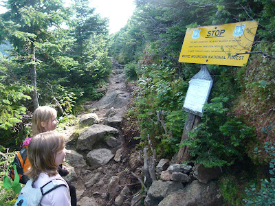
The "Turn back or die" sign...
Treeline! Mt. Franklin, our first objective of the day, stands before us...
This is what most White Mountain trails look like, lol...
Most of the footing in the southern Presidentials is remarkably easy. For a second, we forgot we were in the Whites.
Heading toward Mt. Franklin...
Taking a quick break...
Onward, toward Franklin...
Hiking toward Franklin's summit. The herd path from the main trail (Crawford Path) is distinctive and easy to follow.
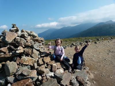
The girls on the summit of Franklin!
The next objective was to go around the peaks of Monroe and claim our bunks at the hut.
Our bunks claimed, we ditched our packs and climbed the half mile to Monroe's summit.
Sage and Alex on the summit of Mt. Monroe. Second time for Sage, fourth time for me and Alex.
We still had four hours before dinner, so we explored a few trails between Lakes and Tuckerman Ravine (specifically, Tuckerman Crossover, bits of the Davis Path, and Camel Trail).
The extremely faded "Turn back or die" sign by Lakes (methinks it needs to be replaced)...
One of the two Lakes...
Looking back at Mt. Monroe and Lakes of the Clouds Hut...
Checking out Tuckerman Crossover...
On Davis Path, between Washington and Boott Spur...
Heading back to Lakes via Camel Trail...
Arriving back at Lakes...
Before going back into the hut, we checked out the many tadpoles and frogs living in the two Lakes of the Clouds...
The girls and I played cards until it was time for dinner. After a hearty meal of soup, salad, pork loin and blondie bars, we headed outside to watch the sunset.
Alex took this picture...
I half-jokingly suggested we grab our headlamps and run back up Monroe. To my surprise, both girls enthusiastically jumped on the idea.
The girls back on the summit of Monroe, watching the remaining light fade from the sky...
Views from Mt. Monroe at sunset...
We were able to make it back down without turning on our headlamps.
Looking back at Mt. Monroe from the hut...
While we were outside stargazing, a young fellow informed us that the International Space Station was about to fly right over the mountains. Seconds after he spoke, a red dot appeared in the western sky. The red turned to white and the station whizzed overhead at (I found out later) over 17,000 miles an hour. The girls and I were flabbergasted at our good fortune. We hadn't planned to see that, this was just a case of being in the right place at the right time.
The next morning, we were awakened by the croo at 6:30. This is customary; usually, someone sits outside the bunk rooms and gently plays a lyrical melody on a flute or guitar. This time around, we got a rousing version of "Psycho Killer." Folks came to breakfast with smiles on their faces.
After eating, the girls and I headed back over the southern Presidentials.
Back around Monroe...
...over Franklin...
...and toward Eisenhower, where Edmands Path awaited.
Somewhere between here and Edmands Path, the same Croc that had fallen off my backpack during a previous hike decided to once again jump ship. Sage noticed it was missing as we neared Edmands Path. Three passing hikers told me they'd look for it on their way north and leave it at the front desk of their motel if they found it. I thanked them for their kindness, but I didn't hold much hope of ever seeing it again.
Of course, since Mt. Eisenhower's summit cone was right there (immediately next to Edmands Path), we had to climb it before descending into the trees...
Upon reaching the summit of Eisenhower, we found that someone with a sense of humor had recently left a trio of tiny climbers on the cairn....
This one had experienced a "negative outcome."
The girls sit on the summit cairn of Mt. Eisenhower. This was Sage's second, Alex's third, and my fifth time on "Ike."
Instead of going back down the way we had come, we elected to descend the other side of Eisenhower, then walk around the mountain on the Crawford Path.
Looking toward Mt. Pierce...
At the intersection with Crawford Path, before walking around Eisenhower's summit...
On the Crawford Path, on the eastern side of Eisenhower's summit...
Back at Edmands Path, looking down into the trees...
The descent on Edmands Path was uneventful and we were soon back at the car.
The next day, Sage and I drove to the appropriate motel, and lo and behold, there was my Croc waiting for me by the front desk. THANK YOU, kind hikers!!! I am so grateful for the return of my ever-escaping Croc!
That's it for the Whites as far as the summer of 2012 goes. We soon leave for the west for some high altitude fun. I will update this blog whenever I'm able, but posts might be few and far between until we return. It will be far easier to post quick messages on Facebook, so check in with us there for fairly up-to-date info on our travels during the next few weeks.
Labels:
Four Thousand Footers,
Lakes of the Clouds,
Lakes of the Clouds Hut,
Mt. Eisenhower,
Mt. Franklin,
Mt. Monroe,
Patricia Ellis Herr,
Trailwrights 72,
Trip Report,
White Mountains
Subscribe to:
Posts (Atom)


